Fuller Fire News Release: Winds spur new growth; protection work continues
July 15, 2016
Fire: Fuller Fire Containment: 0%
Acres: 3,702 Start Date: June 29, 2016
Cause: Lightning Location: Point Imperial, N. Rim Grand Canyon NP
Total Personnel: 430 Fuels/Topography: timber, rugged terrain
Today: Gusty winds and single digit humidity fueled fire growth throughout the day. Fire managers are closely monitoring aggressive fire movement to the south near the Cape Royal Road and Point Imperial Road junction as conditions safely allow. Firefighters will conduct burnout operations along the Cape Royal Road and Point Imperial road junction this evening as conditions allow including hand and aerial ignition. These burnouts will help prevent any further fire spread to the south towards Cape Royal. Hotshot crews and engines will monitor the north and south sides of the fire throughout the night.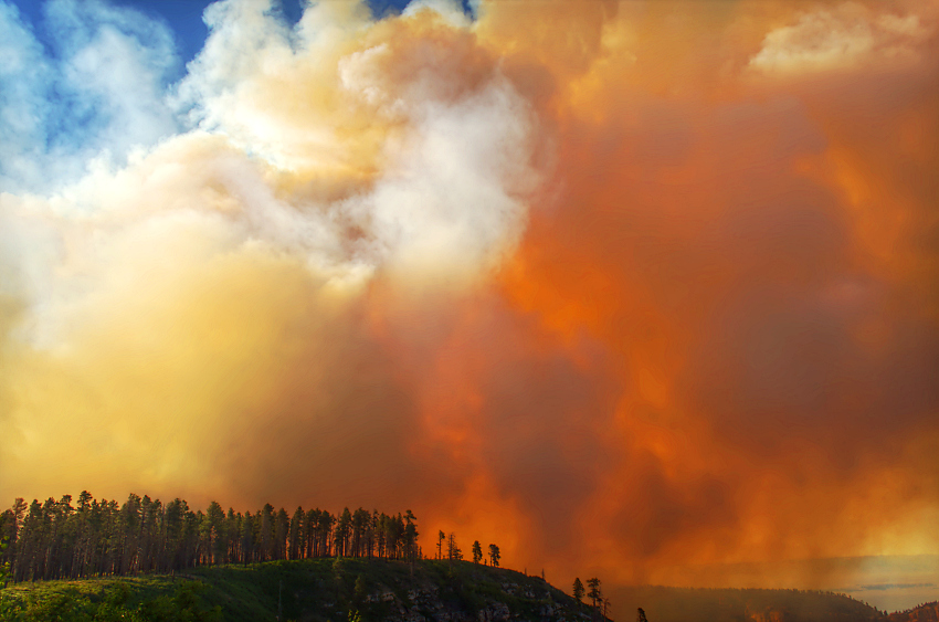
“We are utilizing existing roads and natural features where ever possible to halt the progress of the fire into sensitive areas,” said Incident Commander, Alan Sinclair. “However, firefighter and public safety remain our top priority.”
Crews also worked to build fireline to the north along FSR 610 in advance of future fire spread to the north. Helicopters also strategically dumped water throughout the day as needed.
Tomorrow: Fire managers will continue to focus on safely keeping the fire east of Highway 67, north of Cape Royal Road, and south of FSR 610. Continued strong winds and low humidities will assist fire spread across the landscape. Red flag conditions may limit opportunities for firefighters to safely engage the fire due to the potential for extreme fire behavior.
Smoke: Smoke will continue to disperse to the east and northeast with little to no impacts over the canyon. However, a large column may be visible from Kanab, Marble Canyon, Cameron, the South Rim, and other areas near the fire. For more information on smoke and air quality please visit: wildlandfire.az.gov/links.asp#smoke
Closures: Trails: Arizona Trail: Lindberg Hill north to the Park boundary; Ken Patrick Trail: starting at the Uncle Jim Trail junction; Point Imperial Trail; Nankoweap Trail; Saddle Mountain Trail, South Canyon Trail. Road closures include: Fuller Canyon Road; Cape Royal Road; Point Imperial Road; FSR 610; FSR 611. Closures will be in place until further notice. Park and Forest areas remaining OPEN include the North Rim Visitor Center, Lodge and Campground, Highway 67, FSR 22 and Rainbow Rim Trail.